Map, Subway & Taxis
Three ways to cross Manhattan in seconds. All of them are free, and none of them are delayed due to signal problems.
You can walk between neighboring places, but to get across town, use the map, the subway or a taxi. Travel is always free.
The City Map
Press M or click Map on the toolbar.
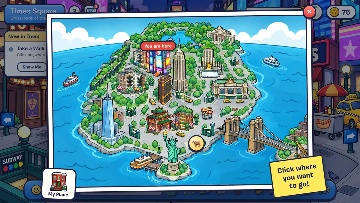
- Click a landmark to go straight there. A You Are Here pin shows where you are now.
- My Place (bottom corner) takes you home to your apartment.
- Subway entrances on the map open the subway map.
- The Statue of Liberty is ferry-only, so clicking it takes you to the ferry dock at Battery Park.
- Wall Street has its own pin, by The Bull.
- Places marked Coming Soon are still being built, like Brooklyn (Coming Soon). Club NYC is Manhattan only for now.
The Subway
Press U or click the MetroCard (Subway) on the toolbar. You can also read the Subway Map poster in the station, or click Board the Train in the Times Sq–42 St Station and choose Ride the Subway.
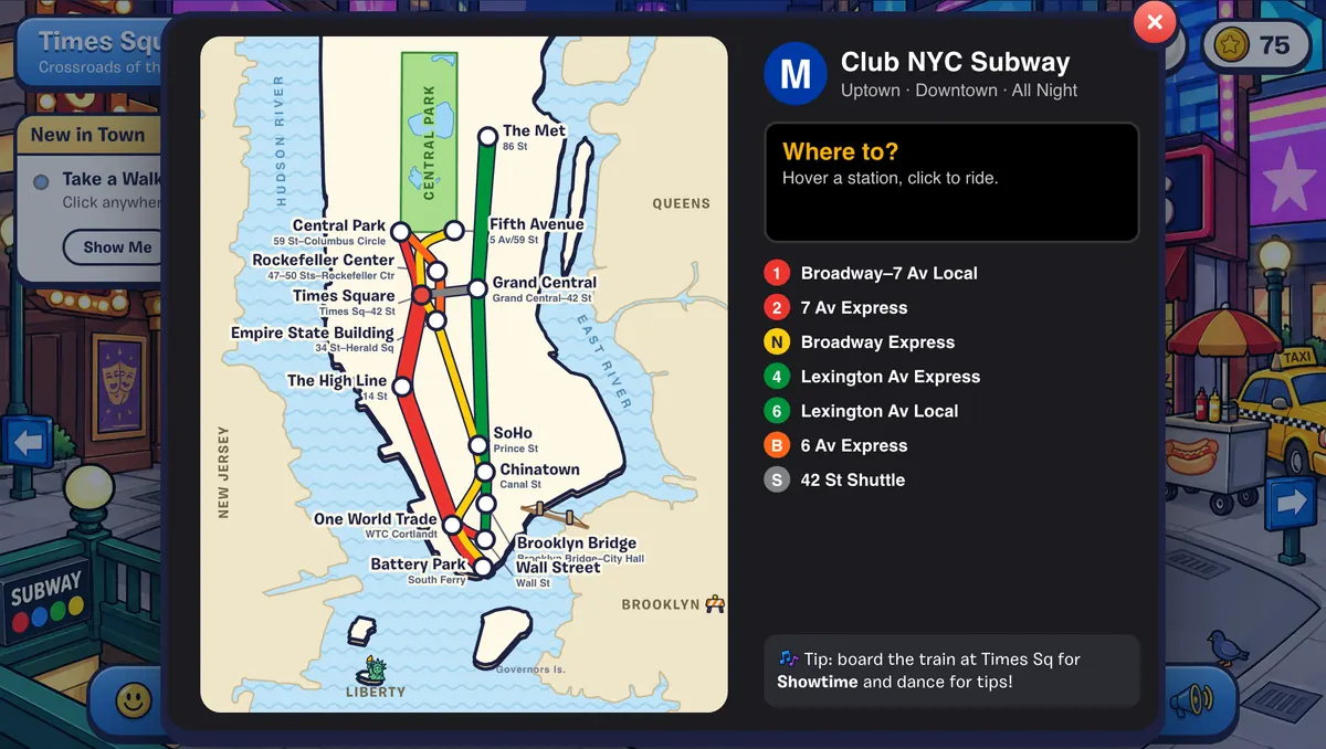
Point at a station to see where it lets you out, then click to ride. The trip takes a few seconds in a swaying subway car, and your first ride earns the Straphanger stamp.
| Station | Lets you out at | Lines |
|---|---|---|
| 86 St | The Met | 4 5 6 |
| 59 St–Columbus Circle | Central Park | 1 A C B D |
| 5 Av/59 St | Fifth Avenue | N R W |
| 47–50 Sts–Rockefeller Ctr | Rockefeller Center | B D F M |
| Times Sq–42 St | Times Sq–42 St Station (stairs up to Times Square) | 1 2 3 7 N Q R W S |
| Grand Central–42 St | Grand Central | 4 5 6 7 S |
| 34 St–Herald Sq | Empire State Building observation deck | B D F M N Q R W |
| 14 St | The High Line | 1 2 3 A C E L |
| Prince St | SoHo | N R W 6 |
| Canal St | Chinatown & Little Italy | J Z N Q R W 6 |
| Brooklyn Bridge–City Hall | Brooklyn Bridge | 4 5 6 J Z |
| WTC Cortlandt | One World Trade | 1 2 3 E R W |
| Wall St | Wall Street | 2 3 4 5 |
| South Ferry | Battery Park | 1 R W |
Taxis
Click Hail a Taxi in Times Square or outside The Met (the street sign on Fifth Avenue works too). Your New Yorker shouts “TAXI!” and the map opens: pick anywhere to go.
Walking Between Places
Neighboring places connect through the exits at their edges:
- Midtown: Times Square, Rockefeller Center, Fifth Avenue, Central Park and The Met, in a row. Grand Central is next to Times Square, and the subway station is under both.
- Downtown: Chelsea Market, the High Line, SoHo, Chinatown & Little Italy and the Brooklyn Bridge.
- Lower Manhattan: Battery Park, One World Trade and Wall Street, in a row, with Wall Street leading on to the Brooklyn Bridge. The ferry goes from Battery Park to Liberty Island, and an elevator goes up to Sky Deck 102.
Inside buildings, look for the door, stairs or elevator back out.